

A Deep Dive into Geospatial
It may not be obvious, but geospatial data is all around us. Every time we check weather apps, consult Google Maps for traffic information, or geotag social media posts, we’re tapping into geospatial data. It’s also becoming increasingly important to use this data to drive business decisions that lead to long-term growth and give them a competitive edge.
What is Geospatial Data?
Here’s the straightforward definition: “Geospatial analytics gathers, manipulates and displays geographic information system (GIS) data and imagery including GPS and satellite photographs. Geospatial data analytics rely on geographic coordinates and specific identifiers such as street address and zip code. They are used to create geographic models and data visualizations for more accurate modeling and predictions of trends.” More simply, geospatial data marks a spatial identifier on land — like a building or geographical reference point (mountains, lakes, etc.) On a business level, geographic data can be tied to customer location, behavior, movement patterns, and shopping behaviors.
Geospatial data can be visualized in two ways. Vector data applies geometric shapes to show the location and shape of geographic features. Features like cities, roads, and waterways are represented by points and lines. This method is scalable, offers smaller file sizes, and is a great way to depict boundaries on maps. Raster data uses a scanned digital image or aerial and satellite images and leverages stair stepping (a cell-based format) to report data as pixels or grids over an image.
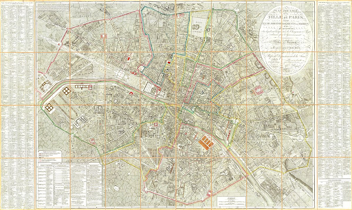
Although geospatial data debuted to a mass audience in 2005 with the launch of Google Maps, the foundation was being built as early as 1832. It was during a cholera outbreak in Paris that French cartographer Charles Picquet created a heatmap to track the spread of illness. In 1854, cholera hit London and physician John Snow used Picquet’s work to identify contaminated water sources and show the connection to the disease.
In the early 20th century, a form of map printing called photozincography was invented, which allowed for the creation of maps through several layers that represented data. Years later, satellite images helped to shape the concept of Geographic Information Systems, which include GIS maps that can contain an unlimited amount of data. This helps users get a comprehensive visualization and analysis to better understand patterns and trends. Further refinement resulted in Google Maps’ 2005 moment.
Geospatial Tech
Common geospatial technology tools include:
- Remote Sensing
- Space or airborne camera
- Geographic Information System (GIS)
- Offers software that can map a specific geographic location anywhere on Earth
- Global Positioning System (GPS)
- Provides coordinate locations for military and civilian use
- Internet Mapping Technologies
- Google Earth and Microsoft Virtual Earth
How Geospatial Data is Used
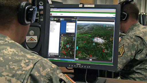
The military is perhaps one of the earliest and most impressive geospatial users. Mission command, intelligence, surveillance, reconnaissance, training area management, and mission support are enhanced by geospatial use by all branches. It can improve operational efficiency, innovates intelligence collection, and helps visualize terrain for defense infrastructure for optimal placement of resources.
Housing and urban development is another popular application of geospatial data. Planners can use datasets to decide how growing urban populations impact energy, housing, and transportation resources and alert decision-makers on the outcomes of crime, public health, and educational initiatives. Planners can also determine the best course of action for infrastructure growth and budgeting. Geospatial data can visualize extreme weather, alert to natural disasters, and help insurance companies assess and mitigate risk. Geologists and project managers in the oil & gas space can use geospatial datasets to reduce costs and minimize risk.
Geospatial data can also be used by businesses to explore trends. Forecasting sales, tracking retail store revenue, assessing insurance policyholder risk by zip code, and marketing campaigns that target a certain demographic in a radius around businesses are strategies that are optimized with the help of geospatial data.
Ultimately, geospatial data is quickly becoming a ubiquitous tool across all industries. When it’s time to establish a geospatial data strategy for your organization, it’s important to work closely with a partner that has a long history of experience working with organizations and cities that need efficient solutions for security, big data management, sustainable mobility and much more.
Reach out to learn more about our team — we focus on developing data platforms and related applications using open source technology. We work with agile software development and can provide technology as a licensed or cloud solution. Let’s talk more.


