

How Geospatial Tools Benefit the Environment
Geospatial technology is all about using tools to analyze Earth and everything on it. Although geospatial technology is useful for many fields and industries, its benefits to sustainability and environmental science are especially impactful. The environmental science field tackles complex issues like land use, conservation, climate change, habitat loss, etc.; geospatial technologies can serve as the numbers and visuals behind these issues. Whether new to the geospatial field or a seasoned professional, you should know how geospatial tools can benefit the environment.
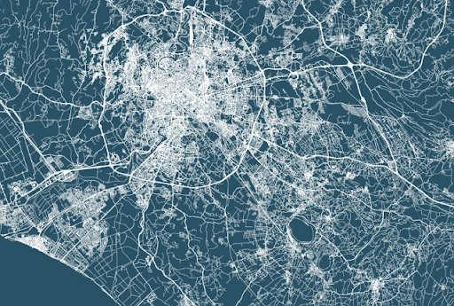
Land Use
Geospatial technology makes tracking land use trends and changes quicker and easier. In most GIS programs, the ability to scale quickly between different levels of an area can help researchers analyze data at local, regional, national, and international levels. Some geospatial software companies, like ESRI, have databases already loaded into their GIS programs or easily accessible. Much land use data has already been transferred and modeled onto maps.
Tracking Urbanization
Similar to land use, urbanization can also be tracked and modeled in many ways with geospatial technology. How cities grow and expand dramatically impacts the natural ecosystems, watersheds, and other communities. Researchers can use GIS tools to model how fast a metropolitan area grows or contrast the growth patterns of various cities. These analyses can bring researchers closer to finding sustainable solutions which minimize environmental impact when a city grows while still safely accommodating its residents.
Conservation Efforts
People working in conservation are constantly adapting to new technologies as Earth’s species continue to disappear at an alarming rate. Geospatial data has proven helpful for researchers to analyze the current distribution of tagged/tracked species and even predict future trends. Migration patterns, habitat changes, and population distributions over time can be tracked and modeled in a GIS program.
Mapping Climate Change
Making atmospheric and meteorological maps with geospatial technology is hugely beneficial. Meteorologists can track and predict short-term weather patterns as well as long-term climate trends. A user’s ability to manipulate how the data is modeled using geospatial technology makes for a greater visual understanding of our atmosphere.
Natural Disaster Mitigation
Another environmental area where geospatial technology has been especially useful is natural disaster communication and mitigation. Atmospheric maps paired with forecasting technology can help to predict natural disaster events. Predictive measures, in turn, help with crisis communication strategies to warn residents of an area of potential harm coming their way. However, the scope of any severe weather event can always fall outside of the predictions. After the disaster, researchers can input damaged areas or recovery sites to aid in remediation and restoration efforts.
Wayfinding and Public Transport
Taking public transportation, biking, and walking are all popular modes of travel with a lower carbon footprint than cars. Trouble can arise when cities do not have proper signage, space, or navigation tools for people to find their way around using these modes of transport. GPS systems are a geospatial technology in themselves. Cities can encourage GPS apps, have interactive maps on screens or kiosks outside, or find other ways to implement geospatial technology for wayfinding.
Carbon Footprint Analysis
Even though many individuals and companies are interested in their carbon footprints, a lot of greenhouse gas emission data is not available or unorganized. Geospatial comes in to remedy this issue with interactive maps showing emissions for a given region. These programs are still being perfected as location intelligence improves.

Safety
Safety is an added effect of many other benefits, such as natural disaster mitigation. Another way that geospatial technology can provide safety relating to the environment is by keeping people working in mines, tunnels, and caves safe. LiDAR scanners can connect with geospatial programs to identify areas that may be subject to a cave-in or collapse. Geospatial technology can also aid public safety measures by identifying the best entrances and exits to areas in case of public emergencies.
Geospatial Is Here to Stay
Beyond the environment, Geospatial technology brings benefits and innovations to countless areas. At T-Kartor, our expert teams work on projects and development in defense, innovation, city wayfinding, satellite imaging, and more. If you are interested in working with us or have any geospatial questions, contact us today!


