

T-Kartor Iris Updates: Enhancing User Experience & Capabilities
By Erik Ravhed, Product Manager
At T-Kartor, innovation is at the heart of what we do. Our cutting-edge geospatial information management platform, Iris, empowers users with tools to integrate, visualize, and analyze complex data. We're excited to share the latest Iris updates, designed to deliver even more robust capabilities and a streamlined experience for our customers and partners.
Here's a look at what's new:
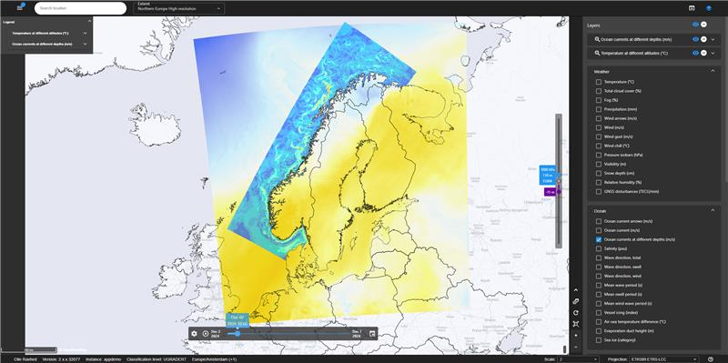
A Fresh Look for the METOC Client
The METOC client now boasts a new look and feel, aligning seamlessly with the Iris client's modern design. Alongside this visual refresh, we've introduced several user experience enhancements. These include:
- Vertical slider for elevation that provides more intuitive control.
- Fine-grained map layer controls give users greater flexibility in customizing their views.
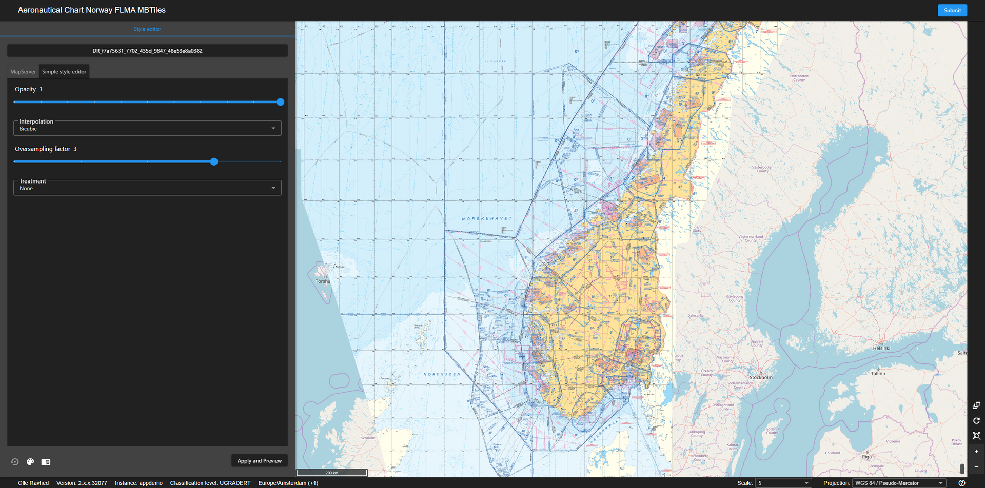
Revamped Style Editor
The Iris style editor has been completely reimagined, offering a sleek interface and expanded functionality. Key updates include:
- Support for MapServer styling syntax, allowing users to apply advanced features to symbolize vector features and raster datasets.
- The ability to preview changes before applying them, ensuring users can verify and refine their styles with confidence before sharing them broadly.
This update empowers users to create highly customized, visually compelling maps with ease.
Enhanced Iris Client Features
The Iris client has received several notable updates to improve functionality and user efficiency:
- Detailed Spatial Searches: Users can now perform more precise spatial queries.
- Simultaneous Feature Information Collection: It's now possible to gather information about multiple features simultaneously, displayed in a table view linked to the map for quick reference.
- Flexible Catalog Search Filtering: In addition to the default intersect operation, users can now configure search results with two new options:
- Contains: Returns results when the search area is entirely within the search result.
- Within: Returns results when the search result is entirely within the search area.
These improvements make extracting meaningful insights and interacting with data in Iris easier than ever.
Ongoing Component Upgrades
With version 2.9, we've made significant upgrades to many core components within Iris, ensuring optimal performance and security. Updates include:
- Elasticsearch for enhanced data indexing and searching.
- Tomcat for reliable server performance.
- Spring Framework for robust application development.
These upgrades are part of our continuous commitment to ensuring Iris remains cutting-edge, secure, and scalable for our users.
Looking Ahead
We're proud of these advancements and excited to see how they enhance the workflows of our customers and partners. As always, our mission is to empower users with tools that not only meet their needs but also inspire new possibilities.
We'd love to hear your thoughts on these updates—what excites you most, and what would you like to see in future releases? Together, let's continue to innovate and push the boundaries of what's possible with Iris.
Thank you for being part of the journey!


