Post-Disaster Damage Assessment Using Geospatial Data
Rapid and accurate damage assessment is critical for effective response and recovery efforts in the wake of natural disasters. Geospatial data and technologies have revolutionized this process, providing detailed, real-time information that can significantly enhance the speed and accuracy of post-disaster evaluations. From satellite imagery to drone surveys, these tools offer unparalleled insights into the extent and nature of the damage, guiding decision-makers in allocating resources, planning recovery, and mitigating future risks.
The Role of Geospatial Data in Damage Assessment
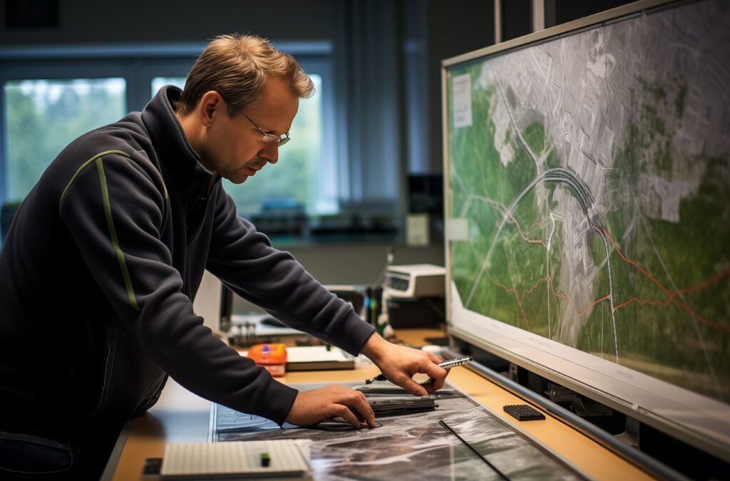
Geospatial data encompasses information derived from satellite images, aerial photographs, uncrewed aerial vehicles (UAVs), and ground-based sensors. This data is integrated into Geographic Information Systems (GIS) to create comprehensive maps and models of affected areas. By leveraging these technologies, emergency responders and planners can assess damage across vast and often inaccessible regions quickly and efficiently.
Satellite Imagery
Satellites with high-resolution cameras and sensors provide a bird’s-eye view of disaster-stricken areas. Before-and-after imagery comparisons are beneficial for identifying changes in the landscape, such as collapsed buildings, flooded regions, and disrupted infrastructure. Modern satellites can capture images at resolutions fine enough to distinguish individual structures, making it possible to assess the damage with remarkable detail.
A striking example occurred in the aftermath of the 2010 Haiti earthquake, where satellite imagery was crucial in mapping the destruction in Port-au-Prince. By comparing pre- and post-earthquake images, analysts identified collapsed buildings, blocked roads, and other critical damage, facilitating the efficient deployment of aid and resources.
Unmanned Aerial Vehicles (UAVs)
Drones have emerged as versatile tools in disaster assessment because of their ability to fly over affected areas and capture high-resolution images and videos. Unlike satellites, drones can operate under cloud cover and provide real-time data, making them invaluable in the immediate aftermath of disasters. Their flexibility allows detailed inspections of specific sites, such as damaged bridges, levees, and buildings.
After Hurricane Maria struck Puerto Rico in 2017, drones were used extensively to survey the damage. The aerial data helped create detailed maps of the hardest-hit areas, guiding recovery efforts and identifying priority zones for aid distribution.

Geographic Information Systems (GIS)
GIS integrates various data sources to create dynamic, interactive maps that highlight the spatial distribution of damage. These systems can incorporate data from satellites, drones, and ground surveys to overview the situation comprehensively. GIS platforms enable analysts to layer different types of data, such as population density, infrastructure locations, and hazard zones, to assess the impact of the disaster more holistically.
During the 2004 Indian Ocean tsunami, GIS combined satellite imagery with demographic data to identify areas with high casualty rates and infrastructure damage. This integration facilitated more effective coordination of international aid and focused recovery efforts in critical areas.
Benefits of Geospatial Data in Post-Disaster Scenarios
The use of geospatial data in post-disaster damage assessment offers several key benefits:
- Speed and Efficiency : Traditional damage assessment methods often require time-consuming ground surveys, which can delay aid delivery. Geospatial data allows for rapid assessment over large areas, significantly speeding up the process.
- Accuracy and Detail : High-resolution imagery and precise GIS mapping provide detailed information about the extent and nature of damage in an area, ensuring adequate resource allocation.
- Accessibility : Geospatial data can be accessed and analyzed remotely, which is crucial when on-the-ground access is limited due to debris, flooding, or other hazards.
- Enhanced Coordination : Geospatial data provides a common operational picture, enabling better coordination among various agencies and organizations involved in the response and recovery efforts.
- Informed Decision-Making : Detailed maps and models help decision-makers understand the full scope of the disaster, prioritize actions, and develop strategies for long-term recovery and resilience.
Challenges and Future Advancements
Despite its advantages, using geospatial data in disaster assessment is not without challenges. High-resolution satellite and drone imagery can be expensive, and the processing and analysis of large datasets require specialized skills and technology. Additionally, regulatory restrictions and logistical issues can hinder timely access to data.
However, technological advances are continually addressing these challenges. The development of more affordable drones, satellite technology improvements, and the availability of open-source GIS platforms are making geospatial data more accessible. Additionally, machine learning and artificial intelligence are being integrated into geospatial analysis, enhancing the speed and accuracy of damage assessments.

Work with T-Kartor
Geospatial data has become indispensable in post-disaster damage assessment, offering detailed, real-time insights critical for effective response and recovery. As technology evolves, its role in disaster management will likely expand, providing even more powerful tools to help communities recover and build resilience against future disasters.
At T-Kartor, our expert teams work on projects and development in defense, innovation, satellite imaging, and more. If you are interested in working with us or have any geospatial questions, contact us today!

Company
Industries
Copyright T-Kartor Inc. All Rights Reserved.


